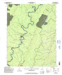
1995 Map of Wildell
USGS Topo · Published 1998About this map
Cheat Mountain and Shavers Mountain dominate this mid-1990s survey of the high Allegheny highlands, where the topography is defined by the winding course of Shavers Fork. The map documents a landscape of managed wilderness and resource extraction within the Monongahela National Forest. Near the center, the Enviro Energy Mine No 2 and various access trails like the Yokum Hunter Access Trail indicate the modern economic activity that persists alongside conservation efforts like the Gaudineer Scenic Area.
Find a feature on this map
46 named features on this map. Tap any name to fly to it.
Don’t see what you’re looking for? This feature index may not catch every label — zoom into the map to look around manually.
Map Details
Editions of this 1995 Wildell Map
This is the sole edition of this map. No revisions or reprints were ever made.
Other maps of this area

1889 · Beverly
USGS Topo · 1:125,000

1892 · Beverly
USGS Topo · 1:125,000

1909 · Elkins
USGS Topo · 1:62,500

1922 · Horton
USGS Topo · 1:48,000

1922 · Spruce Knob
USGS Topo · 1:48,000

1922 · Durbin
USGS Topo · 1:48,000

1924 · Durbin
USGS Topo · 1:62,500

1924 · Horton
USGS Topo · 1:62,500

1924 · Spruce Knob
USGS Topo · 1:62,500

1949 · Charlottesville
USGS Topo · 1:250,000