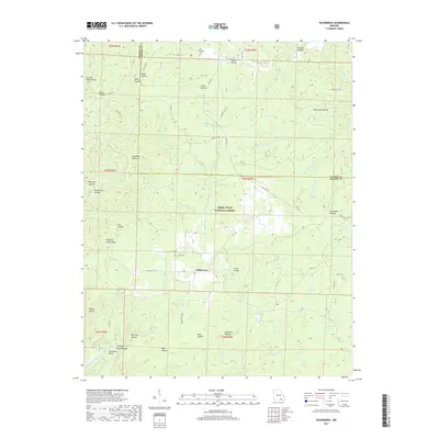
2017 Map of Wilderness
USGS Topo · Published 2017About this map
Wilderness and its surroundings in Oregon and Carter Counties are defined by a complex drainage network within the Mark Twain National Forest. The landscape is etched with numerous named hollows, such as Gold Mine Hollow and Stillhouse Hollow, which suggest a history of early resource extraction and secluded homesteading. Significant water features like the Eleven Point River and its dramatic Horseshoe Bend dominate the southwestern corner, while numerous upland ponds including Cotham Pond and Camp Five Pond provided essential water sources in the high timber. Evidence of former industrial activity is preserved in the path of Old Tram Rd, likely a remnant of the region's logging era. Local heritage is further anchored by the Freeman Cem near the northern boundary and the long-established settlement pattern along Sitton Valley.
Find a feature on this map
63 named features on this map. Tap any name to fly to it.
Don’t see what you’re looking for? This feature index may not catch every label — zoom into the map to look around manually.
Map Details
Editions of this 2017 Wilderness Map
This is the sole edition of this map. No revisions or reprints were ever made.
Other maps of this area

1931 · Bandyville
USGS Topo · 1:48,000

1941 · Gatewood
USGS Topo · 1:62,500

1944 · Van Buren
USGS Topo · 1:62,500

1944 · Couch
USGS Topo · 1:62,500

1944 · Birch Tree
USGS Topo · 1:62,500

1945 · Gatewood
USGS Topo · 1:62,500

1946 · Couch
USGS Topo · 1:62,500

1946 · Van Buren
USGS Topo · 1:62,500

1948 · Birch Tree
USGS Topo · 1:62,500

1957 · Poplar Bluff
USGS Topo · 1:250,000