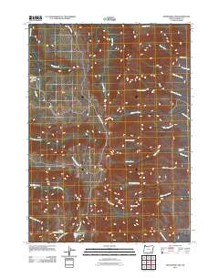
2011 Map of Wildhorse Lake
USGS Topo · Published 2011About this map
Steens Mountain dominates this portion of Harney County, serving as the hydrological divide for numerous alpine drainages. To the south, high-elevation waters gather in Wildhorse Lake and Little Wildhorse Lake before descending via Wildhorse Creek. The landscape is defined by its radial drainage patterns, with the Little Blitzen River flowing westward while Big Alvord Creek and Cottonwood Creek strike out to the east toward the Alvord Desert. Human presence is marked primarily by recreation and seasonal use, evidenced by the Jackman Park Campground and The Hunters Cabin. Steens Mountain RD provides the primary corridor through this high-altitude terrain, passing near landmarks like Devine Rock and crossing the upper reaches of Mosquito Creek and Little McCoy Creek.
Find a feature on this map
28 named features on this map. Tap any name to fly to it.
Don’t see what you’re looking for? This feature index may not catch every label — zoom into the map to look around manually.
Map Details
Editions of this 2011 Wildhorse Lake Map
This is the sole edition of this map. No revisions or reprints were ever made.
Other maps of this area

1955 · Adel
USGS Topo · 1:250,000

1957 · Adel
USGS Topo · 1:250,000

1958 · Adel
USGS Topo · 1:250,000

1962 · Adel
USGS Topo · 1:250,000

1968 · Fish Lake
USGS Topo · 1:24,000

1968 · Wildhorse Lake
USGS Topo · 1:24,000

1968 · Big Pasture Creek
USGS Topo · 1:24,000

1968 · Alvord Hot Springs
USGS Topo · 1:24,000

1968 · Ankle Creek
USGS Topo · 1:24,000
1968 · Mc Coy Ridge
USGS Topo · 1:24,000