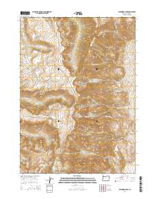
2014 Map of Wildhorse Lake
USGS Topo · Published 2014About this map
Steens Mtn dominates this high-elevation landscape, where the glacial carving of Kiger Gorge and Wildhorse Canyon reveals the dramatic verticality of the Harney County interior. The drainage pattern is complex and radial, with the Little Blitzen River flowing west while other systems like Kiger Cr and Cottonwood Cr move toward the basins below. High-altitude water bodies including Wildhorse Lake and Little Wildhorse Lake sit nestled in steep cirques, serving as the headwaters for the eponymous Wildhorse Cr. Prominent landmarks such as Devine Rock and Castle Rock Cr provide orientation points in this uninhabited terrain, which is largely defined by the Public Land Survey System grids of Township 32 and 33 South. The map illustrates the harsh environmental character of the high desert range, where water is the primary architect of the land.
Find a feature on this map
31 named features on this map. Tap any name to fly to it.
Don’t see what you’re looking for? This feature index may not catch every label — zoom into the map to look around manually.
Map Details
Editions of this 2014 Wildhorse Lake Map
This is the sole edition of this map. No revisions or reprints were ever made.
Other maps of this area

1955 · Adel
USGS Topo · 1:250,000

1957 · Adel
USGS Topo · 1:250,000

1958 · Adel
USGS Topo · 1:250,000

1962 · Adel
USGS Topo · 1:250,000

1968 · Fish Lake
USGS Topo · 1:24,000

1968 · Wildhorse Lake
USGS Topo · 1:24,000

1968 · Big Pasture Creek
USGS Topo · 1:24,000

1968 · Alvord Hot Springs
USGS Topo · 1:24,000

1968 · Ankle Creek
USGS Topo · 1:24,000
1968 · Mc Coy Ridge
USGS Topo · 1:24,000