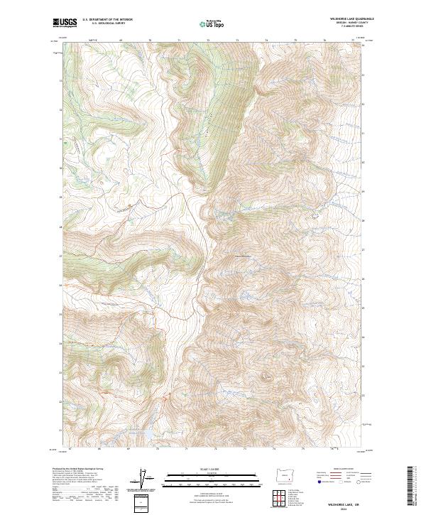
2024 Map of Wildhorse Lake
USGS Topo · Published 2024About this map
Steens Mountain dominates this high-elevation landscape, where the dramatic descent into Kiger Gorge reveals the steep glacial carving of the Oregon high desert. Protected within the Steens Mountain Wilderness, the area is defined by its pristine waterways, including the federally protected Donner Und Blitzen Wild and Scenic River and the Wildhorse and Kiger Creeks Wild and Scenic River. High alpine basins cradle Wildhorse Lake and its smaller neighbor, Little Wildhorse Lake, which serve as the headwaters for Wildhorse Creek. A network of remote paths like the Steens Summit Trl and the Desert Trail provides access to prominent landmarks such as Devine Rock, illustrating the transition from volcanic peaks to the deep canyon floors of the Little Blitzen River.
Find a feature on this map
37 named features on this map. Tap any name to fly to it.
Don’t see what you’re looking for? This feature index may not catch every label — zoom into the map to look around manually.
Map Details
Editions of this 2024 Wildhorse Lake Map
This is the sole edition of this map. No revisions or reprints were ever made.
Other maps of this area

1955 · Adel
USGS Topo · 1:250,000

1957 · Adel
USGS Topo · 1:250,000

1958 · Adel
USGS Topo · 1:250,000

1962 · Adel
USGS Topo · 1:250,000

1968 · Fish Lake
USGS Topo · 1:24,000

1968 · Wildhorse Lake
USGS Topo · 1:24,000

1968 · Big Pasture Creek
USGS Topo · 1:24,000

1968 · Alvord Hot Springs
USGS Topo · 1:24,000

1968 · Ankle Creek
USGS Topo · 1:24,000
1968 · Mc Coy Ridge
USGS Topo · 1:24,000