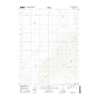
2015 Map of Wildhorse Pass
USGS Topo · Published 2015About this map
Wildhorse Pass and the high peaks of the West Humboldt Range dominate the southeastern portion of this landscape, descending sharply toward the basin floor. This transition from mountainous terrain to the flats of Lower Valley reveals a complex network of 21st-century water management infrastructure designed to divert the Humboldt River. The reliance on irrigation is evident through numerous named waterways including Seven Ditch, Seventeen Ditch, and Sommers Ditch, which feed into the Big Five Reservoir and Big Five Canal. This irrigation system supports the agricultural viability of the valley floor, contrasted against the high, dry ridges of the range. The boundary with Pershing Co is visible at the southern edge, while a series of rural roads such as W Reservation Rd and Peterson Rd provide access through the township and range grid.
Find a feature on this map
23 named features on this map. Tap any name to fly to it.
Don’t see what you’re looking for? This feature index may not catch every label — zoom into the map to look around manually.
Map Details
Editions of this 2015 Wildhorse Pass Map
This is the sole edition of this map. No revisions or reprints were ever made.
Other maps of this area

1908 · Carson Sink
USGS Topo · 1:250,000

1910 · Carson Sink
USGS Topo · 1:250,000

1931 · Lovelock
USGS Topo · 1:250,000

1935 · Lovelock
USGS Topo · 1:250,000

1951 · Carson Sink
USGS Topo · 1:62,500

1955 · Lovelock
USGS Topo · 1:250,000

1956 · Toulon
USGS Topo · 1:62,500

1956 · Lovelock
USGS Topo · 1:62,500

1957 · Reno
USGS Topo · 1:250,000

1959 · Lovelock
USGS Topo · 1:250,000