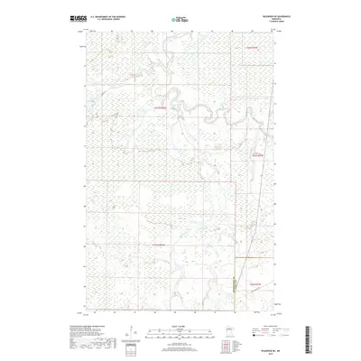
2019 Map of Wildwood NE
USGS Topo · Published 2019About this map
The Big Fork River meanders across the northern portion of this landscape, its tight oxbows defining the local hydrology within the remote borderlands of Itasca and Koochiching counties. This 2019 data illustrates a region dominated by intricate wetland networks, where waterways like Caldwell Brook and Plum Cr feed into the larger river system. Modern access to these timberlands and marshes is facilitated by routes such as Caldwell Rd and the Cutfoot Sioux Trl, which skirts the southern edge of the quadrangle. The map documents the persistent wilderness character of this area, highlighting how water remains the primary sculptor of the terrain, from Wade Brook to the northern reaches of Bowerman Brook.
Find a feature on this map
13 named features on this map. Tap any name to fly to it.
Don’t see what you’re looking for? This feature index may not catch every label — zoom into the map to look around manually.
Map Details
Editions of this 2019 Wildwood NE Map
This is the sole edition of this map. No revisions or reprints were ever made.
Other maps of this area

1918 · Zora
USGS Topo · 1:62,500

1919 · Zora
USGS Topo · 1:62,500

1919 · M
USGS Topo · 1:62,500

1919 · Margie
USGS Topo · 1:62,500

1954 · Hibbing
USGS Topo · 1:250,000

1954 · International Falls
USGS Topo · 1:250,000

1957 · Hibbing
USGS Topo · 1:250,000

1957 · International Falls
USGS Topo · 1:250,000

1958 · International Falls
USGS Topo · 1:250,000

1958 · Hibbing
USGS Topo · 1:250,000