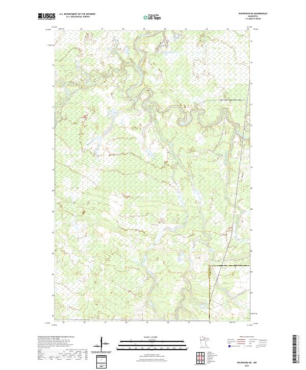
2022 Map of Wildwood NE
USGS Topo · Published 2022About this map
The Big Fork River meanders across this northern Minnesota landscape, creating a complex system of oxbows and riparian wetlands. The terrain is defined by its water network, where smaller tributaries like Plum Cr and Wade Brook feed into the primary river system. This modern survey illustrates the persistent wet character of the region, where road development remains sparse. Primary access is found along Caldwell Rd, which skirts the northern wetlands, while the Cutfoot Sioux Trl crosses the boundary between Koochiching and Itasca counties in the southeast. The map reveals the intricate drainage patterns of the Caldwell Brook and Bowerman Brook, documenting a wilderness environment where the natural movement of the river continues to shape the low-lying topography.
Find a feature on this map
13 named features on this map. Tap any name to fly to it.
Don’t see what you’re looking for? This feature index may not catch every label — zoom into the map to look around manually.
Map Details
Editions of this 2022 Wildwood NE Map
This is the sole edition of this map. No revisions or reprints were ever made.
Other maps of this area

1918 · Zora
USGS Topo · 1:62,500

1919 · Zora
USGS Topo · 1:62,500

1919 · M
USGS Topo · 1:62,500

1919 · Margie
USGS Topo · 1:62,500

1954 · Hibbing
USGS Topo · 1:250,000

1954 · International Falls
USGS Topo · 1:250,000

1957 · Hibbing
USGS Topo · 1:250,000

1957 · International Falls
USGS Topo · 1:250,000

1958 · International Falls
USGS Topo · 1:250,000

1958 · Hibbing
USGS Topo · 1:250,000