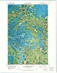
1971 Map of Wildwood NE
USGS Topo · Published 1973About this map
The Big Fork River meanders sharply through a densely wooded landscape in this orthophotomap, which utilizes 1969 aerial photography to reveal the northern Minnesota wilderness. Much of the terrain is defined by the Pine Island State Forest and Big Fork State Forest, showing a network of logging and access routes rather than traditional towns. The presence of the Pine Island Lookout Tower in the southwest and an Old Road Grade suggests a history of timber management and forest fire surveillance.
Find a feature on this map
13 named features on this map. Tap any name to fly to it.
Don’t see what you’re looking for? This feature index may not catch every label — zoom into the map to look around manually.
Map Details
Editions of this 1971 Wildwood NE Map
This is the sole edition of this map. No revisions or reprints were ever made.
Other maps of this area

1918 · Zora
USGS Topo · 1:62,500

1919 · Zora
USGS Topo · 1:62,500

1919 · M
USGS Topo · 1:62,500

1919 · Margie
USGS Topo · 1:62,500

1954 · Hibbing
USGS Topo · 1:250,000

1954 · International Falls
USGS Topo · 1:250,000

1957 · Hibbing
USGS Topo · 1:250,000

1957 · International Falls
USGS Topo · 1:250,000

1958 · International Falls
USGS Topo · 1:250,000

1958 · Hibbing
USGS Topo · 1:250,000