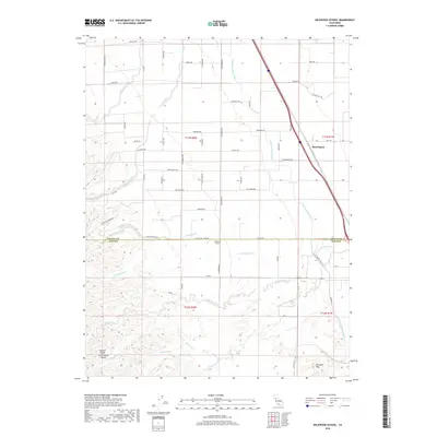
2018 Map of Wildwood School
USGS Topo · Published 2018About this map
Wildwood School sits at the heart of this agricultural landscape along the border of Colusa and Yolo counties. The terrain transitions from the level floor of the Sacramento Valley in the east toward the rising slopes of the Dunnigan Hills in the southwest. This geography is defined by a dense network of seasonal drainages including Petroleum Creek, Little Buckeye Cr, and Wildcat Cr, which cut through the hills before reaching the valley floor. The massive engineering of the Tehama Colusa Canal bisects the region, providing vital irrigation to the surrounding fields. Near the settlement of Harrington, the map details a grid of rural roads and family-named routes like Dahlstrom Rd and Jones Ave, reflecting the localized infrastructure of the Central Valley's farming communities.
Find a feature on this map
66 named features on this map. Tap any name to fly to it.
Don’t see what you’re looking for? This feature index may not catch every label — zoom into the map to look around manually.
Map Details
Editions of this 2018 Wildwood School Map
This is the sole edition of this map. No revisions or reprints were ever made.
Other maps of this area

1888 · Marysville
USGS Topo · 1:125,000

1891 · Marysville
USGS Topo · 1:125,000

1894 · Marysville
USGS Topo · 1:125,000

1895 · Marysville
USGS Topo · 1:125,000

1905 · Harrington
USGS Topo · 1:24,000

1907 · Dunnigan
USGS Topo · 1:62,500

1907 · Colusa
USGS Topo · 1:62,500

1911 · Grimes
USGS Topo · 1:31,680

1916 · Harrington
USGS Topo · 1:31,680

1916 · Hershey
USGS Topo · 1:31,680