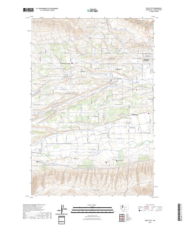
2023 Map of Wiley City
USGS Topo · Published 2023About this map
Ahtanum Creek and the Ahtanum Canal define the lower basin of this landscape, tracing the irrigation-driven development of Yakima County. This area represents a complex agricultural corridor where gravity-fed water systems like Lateral K and Lateral N support established communities such as Gromore and Harwood. The map preserves several significant burial sites, including Saluskin Cem, Emeunot Cem, and the Wah - Lal - La - Kite Cem, which reflect the cultural history of the valley. To the north, the terrain rises toward Cowiche Mtn and Cowiche Canyon, while the social infrastructure is marked by landmarks like the Tietonview Grange. This recent survey illustrates how modern residential expansion and traditional ranching, evidenced by the Wilkinson Ranch Airport, coexist along the base of Ahtanum Ridge.
Find a feature on this map
115 named features on this map. Tap any name to fly to it.
Don’t see what you’re looking for? This feature index may not catch every label — zoom into the map to look around manually.
Map Details
Editions of this 2023 Wiley City Map
This is the sole edition of this map. No revisions or reprints were ever made.
Other maps of this area

1899 · Ellensburg
USGS Topo · 1:125,000

1901 · Ellensburg
USGS Topo · 1:125,000

1937 · White Swan
USGS Topo · 1:125,000

1950 · Yakima
USGS Topo · 1:250,000

1958 · Harrah
USGS Topo · 1:24,000
1958 · Yakima West
USGS Topo · 1:24,000
1958 · Selah
USGS Topo · 1:24,000

1958 · Fort Simcoe
USGS Topo · 1:62,500

1958 · Wiley City
USGS Topo · 1:24,000

1958 · White Swan
USGS Topo · 1:24,000