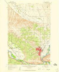
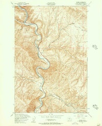
1958 Map of Selah
USGS Topo · Published 1960About this map
Selah serves as the focal point of this late 1950s survey, situated where the Yakima River and Naches River approach their confluence. The landscape is defined by the agricultural development of Selah Heights and the broad Wenas Valley, supported by an intricate network of flumes and siphons. Significant community hubs appear throughout the irrigation districts, including the Wenas Valley Grange, Lower Naches Grange, and the Lower Naches School. Transport and industrial infrastructure are well-documented, from the Northern Pacific railroad lines to the Yakima Valley Transportation Co tracks. Notably, the survey records a Petroglyph located in the northern hills, marking an ancient presence amidst the mid-century expansion of schools like Yakima Valley Sch and Sunset School. This edition captures the valley's character before the intensifications of the later 20th century.
Find a feature on this map
59 named features on this map. Tap any name to fly to it.
Don’t see what you’re looking for? This feature index may not catch every label — zoom into the map to look around manually.
Map Details
Editions of this 1958 Selah Map
4 editions found
Other maps of this area

1899 · Ellensburg
USGS Topo · 1:125,000

1901 · Ellensburg
USGS Topo · 1:125,000

1936 · Yakima East
USGS Topo · 1:48,000

1938 · Badger Pocket
USGS Topo · 1:48,000

1941 · Yakima East
USGS Topo · 1:62,500

1943 · Badger Pocket
USGS Topo · 1:62,500

1950 · Yakima
USGS Topo · 1:250,000

1953 · Pomona
USGS Topo · 1:24,000

1953 · Yakima East
USGS Topo · 1:24,000
1953 · Wymer
USGS Topo · 1:24,000