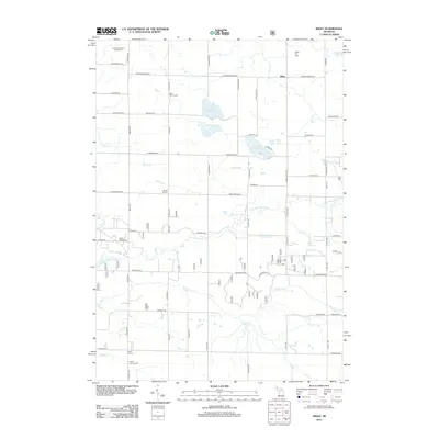
2012 Map of Wiley
USGS Topo · Published 2012About this map
Wiley sits at the intersection of a rural landscape defined by glacial lakes and localized energy production in Mason County. The Wiley Oil Field occupies the northeastern corner of the map, while the Ludington Winter Sports Area in the northwest points to the region's recreational character. This 2012 survey illustrates a well-developed grid of country roads connecting established agricultural crossroads like Smith Corners and Bucks Corners. For those researching local families, the map identifies several distinct burial grounds, including Saint Peter's Cem, Saint Marys Cem, and Eden Cem. The hydrological network is dominated by the N Br Pentwater River and several small water bodies such as North Oxbow Lake, South Oxbow Lake, and Saint Marys Lake, which drain the surrounding woodlots and fields into the larger Lake Michigan watershed to the west.
Find a feature on this map
73 named features on this map. Tap any name to fly to it.
Don’t see what you’re looking for? This feature index may not catch every label — zoom into the map to look around manually.
Map Details
Editions of this 2012 Wiley Map
This is the sole edition of this map. No revisions or reprints were ever made.
Other maps of this area

1931 · Custer NW
USGS Topo · 1:31,680

1931 · Hart NW
USGS Topo · 1:31,680

1931 · Custer SW
USGS Topo · 1:31,680

1931 · Hart NE
USGS Topo · 1:31,680

1931 · Walkerville NW
USGS Topo · 1:31,680

1932 · Ludington NE
USGS Topo · 1:31,680

1932 · Ludington SW
USGS Topo · 1:31,680

1932 · Ludington SE
USGS Topo · 1:31,680

1932 · Ludington
USGS Topo · 1:31,680

1954 · Milwaukee
USGS Topo · 1:250,000