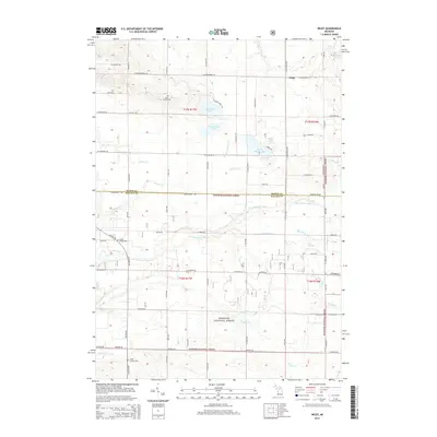
2014 Map of Wiley
USGS Topo · Published 2014About this map
Saint Peters Cem and the small settlement of Wiley anchor the northern reaches of this rural landscape, situated just as the timberlands of the Manistee National Forest begin to dominate the eastern and southern terrain. The area is defined by its complex hydrology, featuring a cluster of glacial water bodies including North Oxbow Lake, South Oxbow Lake, Saint Marys Lake, and the smaller Mud Lake. These lakes feed into a network of small streams and agricultural drains, such as Quinn Cr and Allen Drain, which eventually join the winding path of the N Br Pentwater River.
Find a feature on this map
69 named features on this map. Tap any name to fly to it.
Don’t see what you’re looking for? This feature index may not catch every label — zoom into the map to look around manually.
Map Details
Editions of this 2014 Wiley Map
This is the sole edition of this map. No revisions or reprints were ever made.
Other maps of this area

1931 · Custer NW
USGS Topo · 1:31,680

1931 · Hart NW
USGS Topo · 1:31,680

1931 · Custer SW
USGS Topo · 1:31,680

1931 · Hart NE
USGS Topo · 1:31,680

1931 · Walkerville NW
USGS Topo · 1:31,680

1932 · Ludington NE
USGS Topo · 1:31,680

1932 · Ludington SW
USGS Topo · 1:31,680

1932 · Ludington SE
USGS Topo · 1:31,680

1932 · Ludington
USGS Topo · 1:31,680

1954 · Milwaukee
USGS Topo · 1:250,000