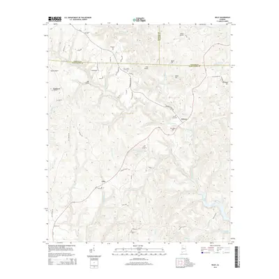
2014 Map of Wiley
USGS Topo · Published 2014About this map
Bankhead Lake defines the southern edge of this landscape where the Big Yellow Creek system drains into the impounded waters of the Black Warrior River. This 2014 survey documents a rugged rural area at the junction of Fayette, Walker, and Tuscaloosa counties. Small communities and family settlements like Wiley, Sandtown, and Whitson are connected by a network of winding county roads and Al-69. The map is particularly useful for genealogical research, identifying numerous family-associated burial grounds including Whitson Place Cem, Earnest Cem, and the Lower Sulpher Springs Cem. Distinctive terrain features like Thompson Mtn and Jess Dunn Hill rise above the complex network of creeks, including Fourmile Cr and Little Yellow Cr, illustrating the deeply dissected topography of the Alabama coal region's surface.
Find a feature on this map
73 named features on this map. Tap any name to fly to it.
Don’t see what you’re looking for? This feature index may not catch every label — zoom into the map to look around manually.
Map Details
Editions of this 2014 Wiley Map
This is the sole edition of this map. No revisions or reprints were ever made.
Other maps of this area

1893 · Jasper
USGS Topo · 1:125,000

1899 · Brookwood
USGS Topo · 1:125,000

1926 · Samantha
USGS Topo · 1:48,000

1928 · Samantha
USGS Topo · 1:62,500

1929 · Searles
USGS Topo · 1:48,000

1934 · Searles
USGS Topo · 1:62,500

1949 · Parrish
USGS Topo · 1:24,000

1949 · Oakman
USGS Topo · 1:24,000

1949 · Tutwiler School
USGS Topo · 1:24,000

1949 · Wiley
USGS Topo · 1:24,000