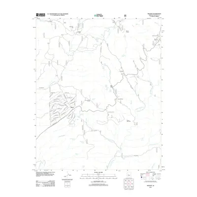
2012 Map of Wilhoit
USGS Topo · Published 2012About this map
Wilhoit serves as the central hub of this modern survey, characterized by a complex network of residential streets such as S Walden Blvd and W Clare Island Dr that contrast with the surrounding high-desert terrain. The landscape is defined by its water management history, featuring numerous named catchments and sources including Wilhoit Tank, Telegraph Spring, and the Hassayampa River. To the north and east, the settlement of Glen Oaks and the Saint Agatha Campground sit near prominent topographical landmarks like Mount Francis and Top of Pines. The distribution of features like the Copper Creek Windmill and Orofino Windmill among the washes and hills reflects a reliance on groundwater infrastructure. This area at the base of Quartz Mountain illustrates the transition from organized community planning in the town site to the more open, resource-dependent tracts of the western Arizona mountains.
Find a feature on this map
80 named features on this map. Tap any name to fly to it.
Don’t see what you’re looking for? This feature index may not catch every label — zoom into the map to look around manually.
Map Details
Editions of this 2012 Wilhoit Map
This is the sole edition of this map. No revisions or reprints were ever made.
Other maps of this area

1887 · Prescott
USGS Topo · 1:250,000

1892 · Prescott
USGS Topo · 1:250,000

1903 · Bradshaw Mountains
USGS Topo · 1:125,000

1903 · Congress
USGS Topo · 1:125,000

1904 · Congress
USGS Topo · 1:125,000

1905 · Jerome
USGS Topo · 1:125,000

1947 · Iron Springs
USGS Topo · 1:62,500

1947 · Mt. Union
USGS Topo · 1:62,500

1947 · Kirkland
USGS Topo · 1:62,500

1947 · Prescott
USGS Topo · 1:62,500