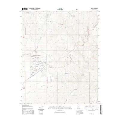
2014 Map of Wilhoit
USGS Topo · Published 2014About this map
The settlement of Wilhoit serves as the primary hub in this southwestern corner of Yavapai County, where a burgeoning network of local roads like W Stevenage Ln and W Claridge Ln meets the established route of State Hwy 89. The landscape is defined by the high-elevation drainage systems of the Prescott National Forest, where water management is critical to the local economy. A series of stock tanks, including Wilhoit Tank, Homestead Tank, and Riggle Tank, are strategically placed among the rugged arroyos of Orofino Wash and Sheppard Wash. This 2014 survey documents the modern intersection of forest land and rural residential development, showing how the community has expanded along the foothills. To the east, the Hassayampa River and its tributaries like Middlewater Cr carve through the terrain, highlighting the complex hydrology of the Arizona highlands.
Find a feature on this map
64 named features on this map. Tap any name to fly to it.
Don’t see what you’re looking for? This feature index may not catch every label — zoom into the map to look around manually.
Map Details
Editions of this 2014 Wilhoit Map
This is the sole edition of this map. No revisions or reprints were ever made.
Other maps of this area

1887 · Prescott
USGS Topo · 1:250,000

1892 · Prescott
USGS Topo · 1:250,000

1903 · Bradshaw Mountains
USGS Topo · 1:125,000

1903 · Congress
USGS Topo · 1:125,000

1904 · Congress
USGS Topo · 1:125,000

1905 · Jerome
USGS Topo · 1:125,000

1947 · Iron Springs
USGS Topo · 1:62,500

1947 · Mt. Union
USGS Topo · 1:62,500

1947 · Kirkland
USGS Topo · 1:62,500

1947 · Prescott
USGS Topo · 1:62,500