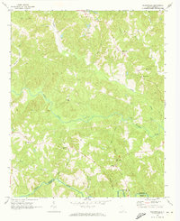
1968 Map of Wilkinsville
USGS Topo · Published 1973About this map
Wilkinsville and Saratt anchor a landscape defined by the winding drainages of the Pacolet River valley during the late 1960s. This rural expanse across the Cherokee Co and Union Co line is characterized by a dense network of country churches that served as the social heart of these communities. From El Bethel Ch in the west to Mesopotamia Ch in the south, these landmarks provide essential anchors for genealogists tracing family roots in this corner of the Piedmont. The topography is intricately carved by numerous waterways including Thicketty Creek, Gilkey Creek, and Abingdon Creek, which dictate the placement of local roads and farmsteads. Smaller hamlets like Gowdeysville and Jefferies appear as quiet junctions, reflecting the area's agricultural character before the expansion of modern infrastructure.
Find a feature on this map
24 named features on this map. Tap any name to fly to it.
Don’t see what you’re looking for? This feature index may not catch every label — zoom into the map to look around manually.
Map Details
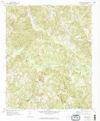
Editions of this 1968 Wilkinsville Map
3 editions found
Other maps of this area

1906 · Kings Mountain
USGS Topo · 1:62,500

1907 · Sharon
USGS Topo · 1:62,500

1908 · Kings Mountain
USGS Topo · 1:62,500

1909 · Gaffney
USGS Topo · 1:62,500

1941 · Spartanburg
USGS Topo · 1:250,000

1953 · Spartanburg
USGS Topo · 1:250,000

1953 · Charlotte
USGS Topo · 1:250,000

1954 · Charlotte
USGS Topo · 1:250,000

1960 · Charlotte
USGS Topo · 1:250,000

1960 · Spartanburg
USGS Topo · 1:250,000