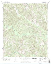
1968 Map of Wilkinsville
USGS Topo · Published 1973About this map
Wilkinsville sits at the heart of this Upstate landscape, where the rolling terrain is defined by an intricate network of watercourses and rural settlements. To the south, the Pacolet River forms a natural boundary between Cherokee and Union counties, joined by tributaries such as Thicketty Creek and Gilkey Creek. The settlement pattern in the late 1960s reflects a deeply rooted community structure, with small centers like Gowdeysville, Saratt, and Jefferies connected by winding country roads. Numerous rural houses of worship serve as local landmarks, including Mesopotamia Ch, Skull Shoals Ch, and Rehobeth Ch. These spiritual hubs, paired with several unnamed cemeteries, suggest a long-standing genealogical footprint in the region. The map captures a moment before significant modern development, documenting the traditional agricultural and residential layout of this South Carolina piedmont area.
Find a feature on this map
23 named features on this map. Tap any name to fly to it.
Don’t see what you’re looking for? This feature index may not catch every label — zoom into the map to look around manually.
Map Details
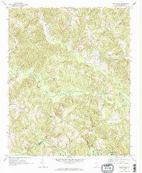
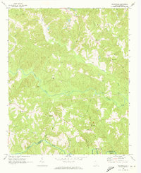
Editions of this 1968 Wilkinsville Map
3 editions found
Other maps of this area

1906 · Kings Mountain
USGS Topo · 1:62,500

1907 · Sharon
USGS Topo · 1:62,500

1908 · Kings Mountain
USGS Topo · 1:62,500

1909 · Gaffney
USGS Topo · 1:62,500

1941 · Spartanburg
USGS Topo · 1:250,000

1953 · Spartanburg
USGS Topo · 1:250,000

1953 · Charlotte
USGS Topo · 1:250,000

1954 · Charlotte
USGS Topo · 1:250,000

1960 · Charlotte
USGS Topo · 1:250,000

1960 · Spartanburg
USGS Topo · 1:250,000