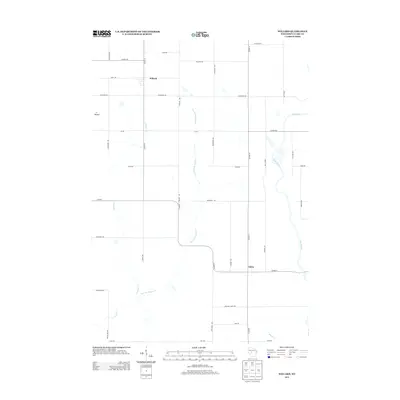
2013 Map of Willard
USGS Topo · Published 2013About this map
Willard and Globe anchor this rural Clark County landscape, where a dense grid of township roads reflects the persistent agricultural layout of central Wisconsin. The terrain is defined by the drainage of the Black River, which cuts across the eastern portion of the sheet, and the winding course of Wedges Cr. Notable local landmarks like S Mound and the headwaters of Mound Cr and Pony Cr provide topographical interest within the structured sections of the county. The map illustrates a region where local travel relies on established routes such as Co Hwy-G and Co Hwy-O, connecting remote farmsteads and small crossroads communities. This survey provides a precise view of land use and water systems in the early twenty-first century, useful for tracing family property lines and rural development.
Find a feature on this map
36 named features on this map. Tap any name to fly to it.
Don’t see what you’re looking for? This feature index may not catch every label — zoom into the map to look around manually.
Map Details
Editions of this 2013 Willard Map
This is the sole edition of this map. No revisions or reprints were ever made.
Other maps of this area

1948 · Fairchild
USGS Topo · 1:62,500

1949 · Fairchild
USGS Topo · 1:62,500

1952 · Stanley
USGS Topo · 1:62,500

1953 · Neillsville
USGS Topo · 1:62,500

1953 · Owen
USGS Topo · 1:48,000

1953 · Eau Claire
USGS Topo · 1:250,000

1958 · Eau Claire
USGS Topo · 1:250,000

1963 · Owen
USGS Topo · 1:62,500

1964 · Eau Claire
USGS Topo · 1:250,000
1979 · Wildcat Mound
USGS Topo · 1:24,000