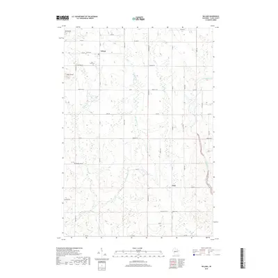
2018 Map of Willard
USGS Topo · Published 2018About this map
The unincorporated community of Willard serves as a primary reference point in this western Clark County landscape, where the local history is anchored by several rural burial grounds. Genealogists and researchers can locate the Willard Cem, the Holy Family Cem, and the Seif Cem further south, providing clear markers of the families who settled this region. The terrain is defined by the drainage of Wedges Cr and its tributaries, such as E Br Wedges Cr, which wind through the township alongside topographic features like Mid Mound and South Mound. In the eastern portion of the map, the Black River enters the frame near Globe, where the road network transitions from the grid of Co Rd G and Co Rd I toward the riverbanks. This 2018 survey captures the enduring rural character of the area, maintaining a pattern of named roads and family-linked landmarks that have persisted for generations.
Find a feature on this map
42 named features on this map. Tap any name to fly to it.
Don’t see what you’re looking for? This feature index may not catch every label — zoom into the map to look around manually.
Map Details
Editions of this 2018 Willard Map
This is the sole edition of this map. No revisions or reprints were ever made.
Other maps of this area

1948 · Fairchild
USGS Topo · 1:62,500

1949 · Fairchild
USGS Topo · 1:62,500

1952 · Stanley
USGS Topo · 1:62,500

1953 · Neillsville
USGS Topo · 1:62,500

1953 · Owen
USGS Topo · 1:48,000

1953 · Eau Claire
USGS Topo · 1:250,000

1958 · Eau Claire
USGS Topo · 1:250,000

1963 · Owen
USGS Topo · 1:62,500

1964 · Eau Claire
USGS Topo · 1:250,000
1979 · Wildcat Mound
USGS Topo · 1:24,000