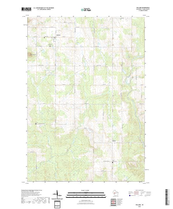
2022 Map of Willard
USGS Topo · Published 2022About this map
Willard and the crossroads community of Globe anchor this rural Clark County landscape, where agriculture and forestry meet the winding waters of the Black River. The area is defined by its drainages, including the bifurcated flow of Wedges Cr and its tributary E Br Wedges Cr, which carve through the terrain south of the prominent South Mound. Local history is deeply etched into the township lines of T26N and T25N, evidenced by a series of communal resting places such as the Willard Cem, Holy Family Cem, and the more secluded Self Cem near Research Farm Rd. This network of country roads, including Co Rd G and Chili Rd, reflects a pattern of long-established farmsteads and rural development that has persisted into the twenty-first century.
Find a feature on this map
45 named features on this map. Tap any name to fly to it.
Don’t see what you’re looking for? This feature index may not catch every label — zoom into the map to look around manually.
Map Details
Editions of this 2022 Willard Map
This is the sole edition of this map. No revisions or reprints were ever made.
Other maps of this area

1948 · Fairchild
USGS Topo · 1:62,500

1949 · Fairchild
USGS Topo · 1:62,500

1952 · Stanley
USGS Topo · 1:62,500

1953 · Neillsville
USGS Topo · 1:62,500

1953 · Owen
USGS Topo · 1:48,000

1953 · Eau Claire
USGS Topo · 1:250,000

1958 · Eau Claire
USGS Topo · 1:250,000

1963 · Owen
USGS Topo · 1:62,500

1964 · Eau Claire
USGS Topo · 1:250,000
1979 · Wildcat Mound
USGS Topo · 1:24,000