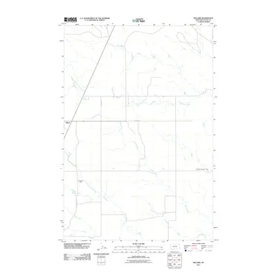
2011 Map of Willard
USGS Topo · Published 2011About this map
Willard sits at the intersection of local routes in this eastern Montana landscape, where the prairie is defined by a dendritic network of intermittent watercourses. The hydrology of this Fallon County region is dominated by Richards Creek and Hidden Water Creek, which carve winding paths across the terrain toward the southeast. The land management of the early 21st century is evident in the presence of small-scale water infrastructure, notably Lindstrom Dam and R Myhre Number 1 Dam, reflecting the critical importance of water storage in this semi-arid ranching and farming environment.
Find a feature on this map
12 named features on this map. Tap any name to fly to it.
Don’t see what you’re looking for? This feature index may not catch every label — zoom into the map to look around manually.
Map Details
Editions of this 2011 Willard Map
This is the sole edition of this map. No revisions or reprints were ever made.
Other maps of this area

1953 · Miles City
USGS Topo · 1:250,000

1957 · Miles City
USGS Topo · 1:250,000

1958 · Miles City
USGS Topo · 1:250,000

1981 · Webster NW
USGS Topo · 1:24,000

1981 · Baker
USGS Topo · 1:100,000

1981 · Buffalo Reservoir
USGS Topo · 1:24,000

1981 · Baker
USGS Topo · 1:24,000

1981 · South Sandstone Reservoir
USGS Topo · 1:24,000

1981 · Willard
USGS Topo · 1:24,000
1981 · Willard SE
USGS Topo · 1:24,000