
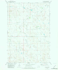
2014 Map of Willard
USGS Topo · Published 2014About this map
Willard sits at the junction of Willard Rd W and the Old Baker Hwy, serving as a central point in this prairie landscape of Fallon County. The area is defined by a dendritic network of seasonal drainages, where Richards Cr and Hidden Water Cr meander through the northern sections, while the N Fork of Dry Cr and Duck Cr dominate the south. These watercourses have historically dictated the placement of rural infrastructure, as seen with roads like Bergstrom Hill Rd following the contours of the terrain.
Find a feature on this map
23 named features on this map. Tap any name to fly to it.
Don’t see what you’re looking for? This feature index may not catch every label — zoom into the map to look around manually.
Map Details
Editions of this 2014 Willard Map
This is the sole edition of this map. No revisions or reprints were ever made.
Other maps of this area

1953 · Miles City
USGS Topo · 1:250,000

1957 · Miles City
USGS Topo · 1:250,000

1958 · Miles City
USGS Topo · 1:250,000

1981 · Webster NW
USGS Topo · 1:24,000

1981 · Baker
USGS Topo · 1:100,000

1981 · Buffalo Reservoir
USGS Topo · 1:24,000

1981 · Baker
USGS Topo · 1:24,000

1981 · South Sandstone Reservoir
USGS Topo · 1:24,000

1981 · Willard
USGS Topo · 1:24,000
1981 · Willard SE
USGS Topo · 1:24,000