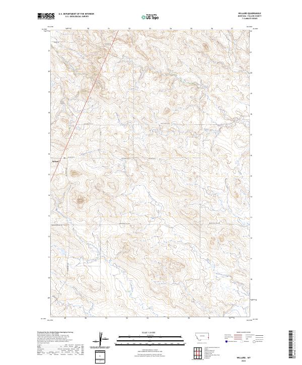
2024 Map of Willard
USGS Topo · Published 2024About this map
Willard stands at the western edge of this Fallon County landscape, situated where Old Baker Hwy meets the local road network. The settlement's presence is marked by a Po, serving as a central point for the surrounding ranching and agricultural lands. The terrain is defined by a series of drainages, including the Richards Creek and South Fork Sandstone Creek systems, which have carved distinct patterns across the township and range grids.
Find a feature on this map
22 named features on this map. Tap any name to fly to it.
Don’t see what you’re looking for? This feature index may not catch every label — zoom into the map to look around manually.
Map Details
Editions of this 2024 Willard Map
This is the sole edition of this map. No revisions or reprints were ever made.
Other maps of this area

1953 · Miles City
USGS Topo · 1:250,000

1957 · Miles City
USGS Topo · 1:250,000

1958 · Miles City
USGS Topo · 1:250,000

1981 · Webster NW
USGS Topo · 1:24,000

1981 · Baker
USGS Topo · 1:100,000

1981 · Buffalo Reservoir
USGS Topo · 1:24,000

1981 · Baker
USGS Topo · 1:24,000

1981 · South Sandstone Reservoir
USGS Topo · 1:24,000

1981 · Willard
USGS Topo · 1:24,000
1981 · Willard SE
USGS Topo · 1:24,000