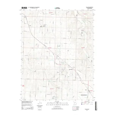
2015 Map of Willard
USGS Topo · Published 2015About this map
The Little Sac River carves through the northeast corner of this Greene County landscape, where the agrarian history of the Ozark Plateau is preserved in a network of family cemeteries and old crossing points. Local heritage is anchored by the Cave Spring Memorial Church and its adjacent Cave Spring Cemetery, alongside other historic burial grounds like Wesley Cemetery and Murray Cemetery. The transport history of the region is evident in the path of the Frisco Highline Trl, which follows the former rail corridor through Willard toward the outskirts of Springfield. Near the river, several historical crossing markers remain, including the Hackney Mill Bridge and Johnson Ford Bridge. The landscape transitions from the developed center of Willard to more rural areas like Pearl and Ritter, defined by springs such as Brower Spring and Clear Creek Spring.
Find a feature on this map
107 named features on this map. Tap any name to fly to it.
Don’t see what you’re looking for? This feature index may not catch every label — zoom into the map to look around manually.
Map Details
Editions of this 2015 Willard Map
This is the sole edition of this map. No revisions or reprints were ever made.
Other maps of this area

1884 · Springfield
USGS Topo · 1:125,000

1886 · Greenfield
USGS Topo · 1:125,000

1886 · Springfield
USGS Topo · 1:125,000

1888 · Greenfield
USGS Topo · 1:125,000

1919 · Halltown
USGS Topo · 1:62,500

1935 · Springfield
USGS Topo · 1:24,000

1936 · Brookline
USGS Topo · 1:24,000

1948 · Willard
USGS Topo · 1:24,000

1948 · Ebenezer
USGS Topo · 1:24,000

1954 · Springfield
USGS Topo · 1:250,000