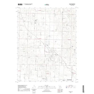
2017 Map of Willard
USGS Topo · Published 2017About this map
Willard serves as a central hub on this 2017 survey, located northwest of the expanding Springfield metropolitan area. The landscape is defined by the winding course of the Little Sac River in the northeast and several significant springs, including Brower Spring and Clear Creek Spring. The map documents a transition from established agricultural lands to suburban growth, evidenced by the dense grid of farm roads such as W Farm Rd 48 and Farm Rd 54 surrounding smaller settlements like Pearl and Ritter. Local history is preserved in several rural burial grounds, including Wesley Cem, Murray Cem, and the Cave Spring Memorial Church Cem near the Cave Spring community. Historic river crossings are well-documented, featuring several named bridges like Hackney Mill Bridge and Sneeds Bridge that once facilitated local commerce and travel across the river and its tributaries.
Find a feature on this map
74 named features on this map. Tap any name to fly to it.
Don’t see what you’re looking for? This feature index may not catch every label — zoom into the map to look around manually.
Map Details
Editions of this 2017 Willard Map
This is the sole edition of this map. No revisions or reprints were ever made.
Other maps of this area

1884 · Springfield
USGS Topo · 1:125,000

1886 · Greenfield
USGS Topo · 1:125,000

1886 · Springfield
USGS Topo · 1:125,000

1888 · Greenfield
USGS Topo · 1:125,000

1919 · Halltown
USGS Topo · 1:62,500

1935 · Springfield
USGS Topo · 1:24,000

1936 · Brookline
USGS Topo · 1:24,000

1948 · Willard
USGS Topo · 1:24,000

1948 · Ebenezer
USGS Topo · 1:24,000

1954 · Springfield
USGS Topo · 1:250,000