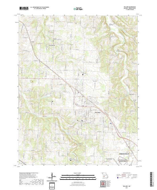
2021 Map of Willard
USGS Topo · Published 2021About this map
Willard serves as the central hub of this Greene County landscape, situated where the Frisco Highline Trl cuts diagonally through the terrain. The map documents a transition from the developing edges of Springfield and the Springfield-Branson National Airport in the south toward the rural reaches of Pearl and Cave Spring in the north. This area is heavily defined by its water systems and early river crossings, featuring several historically named bridges such as Hackney Mill Bridge and Sneeds Bridge over the Little Sac River. Local history is deeply preserved in numerous family and community burial grounds, including the Cave Spring Memorial Church-Cem, Wesley Cem, and Gilmore Cem. The presence of Brower Spring and Clear Creek Spring indicates the importance of natural water sources to the early settlement pattern of these Missouri townships.
Find a feature on this map
119 named features on this map. Tap any name to fly to it.
Don’t see what you’re looking for? This feature index may not catch every label — zoom into the map to look around manually.
Map Details
Editions of this 2021 Willard Map
This is the sole edition of this map. No revisions or reprints were ever made.
Other maps of this area

1884 · Springfield
USGS Topo · 1:125,000

1886 · Greenfield
USGS Topo · 1:125,000

1886 · Springfield
USGS Topo · 1:125,000

1888 · Greenfield
USGS Topo · 1:125,000

1919 · Halltown
USGS Topo · 1:62,500

1935 · Springfield
USGS Topo · 1:24,000

1936 · Brookline
USGS Topo · 1:24,000

1948 · Willard
USGS Topo · 1:24,000

1948 · Ebenezer
USGS Topo · 1:24,000

1954 · Springfield
USGS Topo · 1:250,000