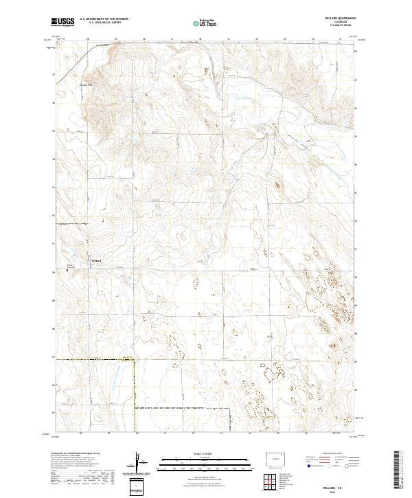
2022 Map of Willard
USGS Topo · Published 2022About this map
Willard sits at the base of the Pawnee Hills, marking a pocket of settlement in the high plains of Logan County. The landscape is defined by the broad Pawnee Valley, where seasonal drainage from Sand Creek and Pawnee Creek cuts through the terrain. Evidence of regional water management is prominent, with the North Sterling Canal and the Riverside Intake Canal traversing the eastern and southern portions of the quadrangle. These irrigation features indicate the area's agricultural importance, providing a stark contrast to the surrounding upland slopes. Local history is anchored by the Prairie Lawn Cem located just west of the main settlement. The map also documents the transition from Logan County to Morgan County along its southern boundary, linked by a network of county roads including Co RD 14 and Co RD 18 that follow the section lines of the Public Land Survey System.
Find a feature on this map
35 named features on this map. Tap any name to fly to it.
Don’t see what you’re looking for? This feature index may not catch every label — zoom into the map to look around manually.
Map Details
Editions of this 2022 Willard Map
This is the sole edition of this map. No revisions or reprints were ever made.
Other maps of this area

1951 · Willard
USGS Topo · 1:24,000

1951 · Messex
USGS Topo · 1:24,000

1951 · Antelope Springs
USGS Topo · 1:24,000

1951 · Wild Horse Lake
USGS Topo · 1:24,000

1951 · Atwood NE
USGS Topo · 1:24,000

1951 · Merino
USGS Topo · 1:24,000

1951 · Atwood
USGS Topo · 1:24,000

1954 · Sterling
USGS Topo · 1:250,000

1958 · Sterling
USGS Topo · 1:250,000

1971 · Messex
USGS Topo · 1:24,000