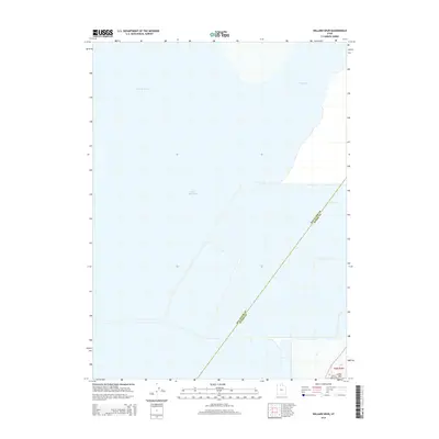
2014 Map of Willard Spur
USGS Topo · Published 2014About this map
Bear River Bay and the northern reaches of the Great Salt Lake dominate this 2014 geographic study of the interface between Utah’s saline waters and the marshy inlets of the Bear River delta. The survey highlights the vast aquatic expanse of Willard Spur, a significant hydrological feature situated within the larger bay system. The landscape is defined by its low-lying, often submerged character, where water levels dictate the shifting shoreline. In the southeastern corner of the map, the terrain rises at Little Mtn, providing a rare point of elevation overlooking the surrounding wetlands. This particular survey is notable for its depiction of the administrative boundary dividing Box Elder and Weber counties as it cuts diagonally across the open water and mudflats.
Find a feature on this map
6 named features on this map. Tap any name to fly to it.
Don’t see what you’re looking for? This feature index may not catch every label — zoom into the map to look around manually.
Map Details
Editions of this 2014 Willard Spur Map
This is the sole edition of this map. No revisions or reprints were ever made.
Other maps of this area

1954 · Whistler Canal
USGS Topo · 1:24,000

1954 · Brigham City
USGS Topo · 1:250,000

1955 · Willard Spur
USGS Topo · 1:24,000

1955 · Mouth of Bear River
USGS Topo · 1:24,000

1955 · Plain City SW
USGS Topo · 1:24,000

1955 · Ogden Bay
USGS Topo · 1:24,000

1955 · Fremont Island
USGS Topo · 1:24,000

1958 · Brigham City
USGS Topo · 1:250,000

1962 · Brigham City
USGS Topo · 1:250,000

1967 · East Promontory
USGS Topo · 1:24,000