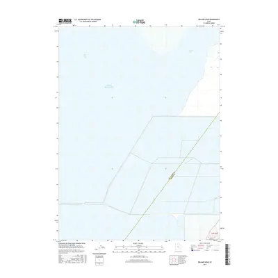
2017 Map of Willard Spur
USGS Topo · Published 2017About this map
Great Salt Lake dominates the expanse of this coastal wetland and aquatic environment along the eastern margins of Utah’s famous saline sea. The interface between freshwater inflow and the lake is captured through the Bear River Bay and the shallow waters of Willard Spur. This 2017 survey delineates the boundary between Box Elder and Weber counties as it traverses the lake bed, reflecting a landscape defined by seasonal water levels and extensive diking systems designed to manage these critical marsh habitats. The grid-like patterns of these embankments show the human effort to partition and control the hydrology of the bay, providing a detailed look at the infrastructure that supports local bird populations and water conservation efforts in this unique ecosystem.
Find a feature on this map
5 named features on this map. Tap any name to fly to it.
Don’t see what you’re looking for? This feature index may not catch every label — zoom into the map to look around manually.
Map Details
Editions of this 2017 Willard Spur Map
This is the sole edition of this map. No revisions or reprints were ever made.
Other maps of this area

1954 · Whistler Canal
USGS Topo · 1:24,000

1954 · Brigham City
USGS Topo · 1:250,000

1955 · Willard Spur
USGS Topo · 1:24,000

1955 · Mouth of Bear River
USGS Topo · 1:24,000

1955 · Plain City SW
USGS Topo · 1:24,000

1955 · Ogden Bay
USGS Topo · 1:24,000

1955 · Fremont Island
USGS Topo · 1:24,000

1958 · Brigham City
USGS Topo · 1:250,000

1962 · Brigham City
USGS Topo · 1:250,000

1967 · East Promontory
USGS Topo · 1:24,000