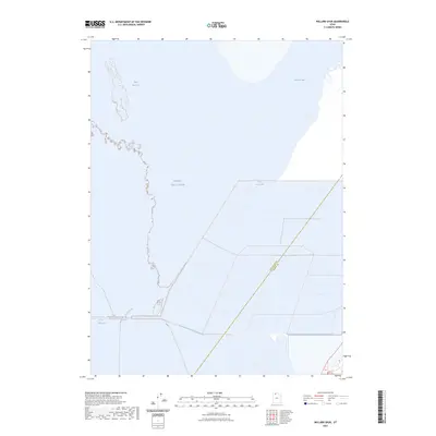
2023 Map of Willard Spur
USGS Topo · Published 2023About this map
Great Salt Lake dominates this coastal landscape where the northern waters meet the marshy edges of the shoreline. The transition between the open lake and the Bear River Bay area provides a clear view of the hydrological dynamics in this part of Utah, showing where the freshwater influence of the river systems enters the saline environment. Along the eastern edge, the Willard Spur identifies a significant shallow-water area crucial for migratory birds and local water management. The boundary line between Box Elder Co and Weber Co runs through the aquatic expanse, marking a jurisdictional divide that cuts across the water. This 2023 survey serves as a modern record of the shoreline and wetland extent, highlighting the fragile boundary between the lake's fluctuating levels and the surrounding marshes.
Find a feature on this map
5 named features on this map. Tap any name to fly to it.
Don’t see what you’re looking for? This feature index may not catch every label — zoom into the map to look around manually.
Map Details
Editions of this 2023 Willard Spur Map
This is the sole edition of this map. No revisions or reprints were ever made.
Other maps of this area

1954 · Whistler Canal
USGS Topo · 1:24,000

1954 · Brigham City
USGS Topo · 1:250,000

1955 · Willard Spur
USGS Topo · 1:24,000

1955 · Mouth of Bear River
USGS Topo · 1:24,000

1955 · Plain City SW
USGS Topo · 1:24,000

1955 · Ogden Bay
USGS Topo · 1:24,000

1955 · Fremont Island
USGS Topo · 1:24,000

1958 · Brigham City
USGS Topo · 1:250,000

1962 · Brigham City
USGS Topo · 1:250,000

1967 · East Promontory
USGS Topo · 1:24,000