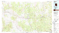
1983 Map of Williams
USGS Topo · Published 1984About this map
Williams serves as a principal gateway to the northern Arizona highlands, situated at the base of the prominent Bill Williams Mountain. The landscape is defined by the transition from the high desert of the Coconino Plateau into the dense timber of the Kaibab National Forest and Prescott National Forest. This era shows the critical transportation corridor formed by the Atchison Topeka and Santa Fe railroad and the parallel routes of Us 66 and Interstate 40.
Find a feature on this map
71 named features on this map. Tap any name to fly to it.
Don’t see what you’re looking for? This feature index may not catch every label — zoom into the map to look around manually.
Map Details
Editions of this 1983 Williams Map
3 editions found
Other maps of this area

1886 · Diamond Creek
USGS Topo · 1:250,000

1886 · San Francisco Mtns
USGS Topo · 1:250,000

1886 · Chino
USGS Topo · 1:250,000

1887 · Verde
USGS Topo · 1:250,000

1887 · Prescott
USGS Topo · 1:250,000

1891 · San Francisco Mtns
USGS Topo · 1:250,000

1891 · Chino
USGS Topo · 1:250,000

1892 · Verde
USGS Topo · 1:250,000

1892 · Diamond Creek
USGS Topo · 1:250,000

1892 · Prescott
USGS Topo · 1:250,000