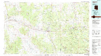
1983 Map of Williams
USGS Topo · Published 1984About this map
Williams serves as the focal point for this survey of the high plateau country of northern Arizona, where the timbered slopes of the Kaibab National Forest meet the deep drainages of Cataract Canyon and Hell Canyon. The landscape is dominated by volcanic features like Bill Williams Mountain and Sitgreaves Mtn, alongside significant water management sites such as Dogtown Reservoir and JD Dam Lake. The corridor of the Atchison Topeka and Santa Fe railroad remains a primary industrial artery, connecting the ranching and transit hubs of Ash Fork and Seligman. The map reveals a transition from the dense woodlands of the Prescott National Forest in the south to the open rangelands of the Aubrey Valley, punctuated by numerous quarries and remote landings like the Chapman Ranch Airstrip.
Find a feature on this map
71 named features on this map. Tap any name to fly to it.
Don’t see what you’re looking for? This feature index may not catch every label — zoom into the map to look around manually.
Map Details
Editions of this 1983 Williams Map
3 editions found
Other maps of this area

1886 · Diamond Creek
USGS Topo · 1:250,000

1886 · San Francisco Mtns
USGS Topo · 1:250,000

1886 · Chino
USGS Topo · 1:250,000

1887 · Verde
USGS Topo · 1:250,000

1887 · Prescott
USGS Topo · 1:250,000

1891 · San Francisco Mtns
USGS Topo · 1:250,000

1891 · Chino
USGS Topo · 1:250,000

1892 · Verde
USGS Topo · 1:250,000

1892 · Diamond Creek
USGS Topo · 1:250,000

1892 · Prescott
USGS Topo · 1:250,000