
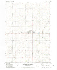
1978 Map of Williams
USGS Topo · Published 1979About this map
The Illinois Central Gulf railroad cuts through the northern section of Hamilton County, passing through the town of Williams. This 1970s survey captures a landscape at a crossroads of infrastructure, where the traditional rail-and-river economy meets the modern era of interstate travel. The Interstate 35 and Interstate 20 corridors intersect here, reshaping the rural townships of Rose Grove, Liberty, and Blairsburg. Local heritage remains anchored by several religious and community landmarks, including St Marys Ch and its adjacent St Marys Cem, alongside the Rose Grove Ch further south. The natural drainage of the region is defined by the South Skunk River and Tipton Creek, while artificial drainage like Ditch No 64 illustrates the intensive agricultural management of the Iowa prairie.
Find a feature on this map
21 named features on this map. Tap any name to fly to it.
Don’t see what you’re looking for? This feature index may not catch every label — zoom into the map to look around manually.
Map Details
Editions of this 1978 Williams Map
This is the sole edition of this map. No revisions or reprints were ever made.
Other maps of this area

1954 · Waterloo
USGS Topo · 1:250,000

1955 · Waterloo
USGS Topo · 1:250,000

1978 · Blairsburg
USGS Topo · 1:24,000

1978 · Ellsworth
USGS Topo · 1:24,000

1978 · Sheldon Creek
USGS Topo · 1:24,000

1978 · Jewell
USGS Topo · 1:24,000

1978 · Clarion SW
USGS Topo · 1:24,000

1979 · Buckeye West
USGS Topo · 1:24,000

1979 · Popejoy
USGS Topo · 1:24,000
1979 · Radcliffe
USGS Topo · 1:24,000