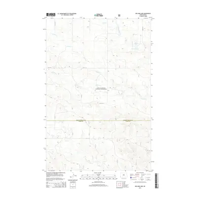
2014 Map of Williams Lake
USGS Topo · Published 2014About this map
The Little Missouri National Grassland dominates this section of the western North Dakota high plains, where the drainage basins of several key tributaries intersect. The landscape is defined by the winding paths of Bull Run Cr and Cottonwood Cr, which carve through the terrain before crossing the county line shared by Slope and Golden Valley counties. In the northeast, the presence of William Lake and the Williams Reservoir indicates the critical importance of managed water resources in this arid cattle-ranching region. Further south, Horse Cr cuts through the topography, illustrating the intricate network of coulees and draws that characterize the Badlands periphery. This survey captures the remote character of the grasslands, showing how the natural drainage systems dictated the placement of ranch roads and boundaries in a sparsely settled corner of the state.
Find a feature on this map
9 named features on this map. Tap any name to fly to it.
Don’t see what you’re looking for? This feature index may not catch every label — zoom into the map to look around manually.
Map Details
Editions of this 2014 Williams Lake Map
This is the sole edition of this map. No revisions or reprints were ever made.
Other maps of this area

1953 · Miles City
USGS Topo · 1:250,000

1953 · Dickinson
USGS Topo · 1:250,000

1957 · Dickinson
USGS Topo · 1:250,000

1957 · Miles City
USGS Topo · 1:250,000

1958 · Miles City
USGS Topo · 1:250,000

1979 · Three V Crossing
USGS Topo · 1:24,000

1980 · Golva
USGS Topo · 1:24,000

1980 · Pretty Butte
USGS Topo · 1:24,000

1980 · Boyce Creek West
USGS Topo · 1:24,000

1980 · Alpha
USGS Topo · 1:24,000