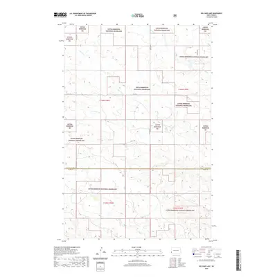
2020 Map of Williams Lake
USGS Topo · Published 2020About this map
Little Missouri National Grassland dominates this landscape along the border of Golden Valley and Slope counties. The terrain is defined by a network of drainage systems, including the winding paths of Bull Run Cr and Cottonwood Cr, which carve through the high prairie. In the northeastern corner, William Lake provides a rare permanent water feature in this arid region of the Badlands. The map reveals a strictly regulated grid of section lines and range roads, such as 168th Ave SW and 57th St SW, which overlay the natural topography. This juxtaposition highlights the tension between early 20th-century land surveying and the reality of the Western North Dakota environment, where seasonal waterways like Williams Cr and Horse Cr dictate the movement of both livestock and wildlife across the public range.
Find a feature on this map
18 named features on this map. Tap any name to fly to it.
Don’t see what you’re looking for? This feature index may not catch every label — zoom into the map to look around manually.
Map Details
Editions of this 2020 Williams Lake Map
This is the sole edition of this map. No revisions or reprints were ever made.
Other maps of this area

1953 · Miles City
USGS Topo · 1:250,000

1953 · Dickinson
USGS Topo · 1:250,000

1957 · Dickinson
USGS Topo · 1:250,000

1957 · Miles City
USGS Topo · 1:250,000

1958 · Miles City
USGS Topo · 1:250,000

1979 · Three V Crossing
USGS Topo · 1:24,000

1980 · Golva
USGS Topo · 1:24,000

1980 · Pretty Butte
USGS Topo · 1:24,000

1980 · Boyce Creek West
USGS Topo · 1:24,000

1980 · Alpha
USGS Topo · 1:24,000