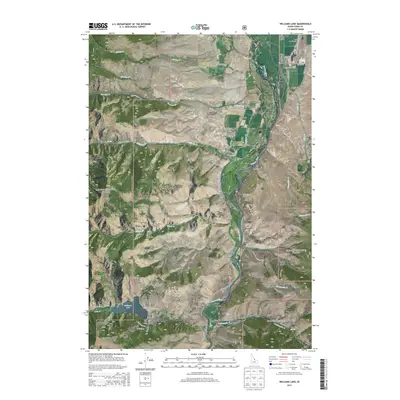
2013 Map of Williams Lake
USGS Topo · Published 2013About this map
The Salmon River carves a deep corridor through the Salmon National Forest, dividing the Salmon River Mountains to the west from the Lemhi Range in the east. This landscape is defined by its dramatic relief and the network of drainages—such as Tenmile Cr and Elevenmile Cr—that feed into the river valley. The settlement pattern is concentrated along the narrow riparian benches and mountain basins, most notably at the Williams Lake Resort on the shores of Williams Lake. In the northern portion of the quadrangle, the Lemhi County Airport sits near the valley floor, connected to the surrounding highlands by a web of Forest Service roads like Williams Creek Rd and Perreau Creek Rd. Private holdings like the Lake Creek Ranch represent the persistent agricultural and residential presence within these federally managed lands.
Find a feature on this map
46 named features on this map. Tap any name to fly to it.
Don’t see what you’re looking for? This feature index may not catch every label — zoom into the map to look around manually.
Map Details
Editions of this 2013 Williams Lake Map
This is the sole edition of this map. No revisions or reprints were ever made.
Other maps of this area

1950 · Salmon
USGS Topo · 1:62,500

1950 · Leesburg
USGS Topo · 1:62,500

1951 · Leesburg
USGS Topo · 1:62,500

1951 · Salmon
USGS Topo · 1:62,500

1955 · Dubois
USGS Topo · 1:250,000

1955 · Dillon
USGS Topo · 1:250,000

1956 · Elk City
USGS Topo · 1:250,000

1957 · Dillon
USGS Topo · 1:250,000

1957 · Challis
USGS Topo · 1:250,000

1958 · Dubois
USGS Topo · 1:250,000