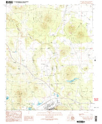
1989 Map of Williams North
USGS Topo · Published 1990About this map
Williams serves as the focal point for this northern Arizona landscape, situated at the doorstep of the Kaibab National Forest. The map documents a transition from the town’s urban infrastructure—including Athletic Fields, a Golf Course, and Sewage Disposal Ponds—to the surrounding high-elevation plateaus and canyons. A complex water management system is evident through a series of named tanks and lakes, such as Threemile Lake, Holden Lake, and Cataract Lake, which provide critical resources in this arid environment.
Find a feature on this map
51 named features on this map. Tap any name to fly to it.
Don’t see what you’re looking for? This feature index may not catch every label — zoom into the map to look around manually.
Map Details
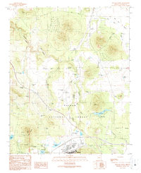
Editions of this 1989 Williams North Map
2 editions found
Other maps of this area

1886 · Chino
USGS Topo · 1:250,000

1891 · Chino
USGS Topo · 1:250,000

1922 · Williams
USGS Topo · 1:125,000

1947 · Ash Fork
USGS Topo · 1:62,500

1948 · Ash Fork
USGS Topo · 1:63,360

1948 · Williams
USGS Topo · 1:250,000

1949 · Ash Fork
USGS Topo · 1:62,500

1954 · Williams
USGS Topo · 1:250,000

1956 · Williams
USGS Topo · 1:250,000

1960 · Williams
USGS Topo · 1:250,000