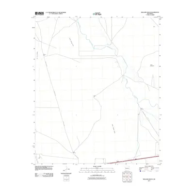
2010 Map of Williams Ranch
USGS Topo · Published 2010About this map
Williams Ranch and the small settlement of Willis define the northern expanse of this high-desert landscape in Luna County. The Mimbres River cuts a winding path through the eastern half of the quadrangle, supported by water infrastructure like the Wamel Canal and reliable water sources such as Middle Well and North Windmill. This 2010 survey reveals the agricultural and ranching footprint of the region, where the terrain is marked by prominent elevations like Clabber Top Hill and Black Mountain. In the south, the community of Tunis sits along the interstate corridor, providing a clear contrast between the modern transit artery and the long-established ranching outposts like Lauer. The drainage patterns of Jones Springs Draw further illustrate the hydrology of this arid basin near the southern border.
Find a feature on this map
17 named features on this map. Tap any name to fly to it.
Don’t see what you’re looking for? This feature index may not catch every label — zoom into the map to look around manually.
Map Details
Editions of this 2010 Williams Ranch Map
This is the sole edition of this map. No revisions or reprints were ever made.
Other maps of this area

1899 · Deming
USGS Topo · 1:125,000

1915 · Deming
USGS Topo · 1:125,000

1954 · Silver City
USGS Topo · 1:250,000

1955 · Las Cruces
USGS Topo · 1:250,000

1958 · Las Cruces
USGS Topo · 1:250,000

1958 · Silver City
USGS Topo · 1:250,000

1962 · Silver City
USGS Topo · 1:250,000
1963 · Antelope Hill
USGS Topo · 1:24,000

1963 · Gage
USGS Topo · 1:24,000
1964 · Grandmother Mountain East
USGS Topo · 1:24,000