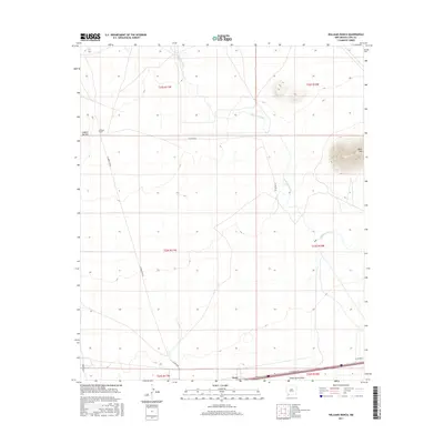
2017 Map of Williams Ranch
USGS Topo · Published 2017About this map
Williams Ranch and the small settlement of Tunis anchor this high desert landscape in Luna County during the mid-2010s. The terrain is defined by the ephemeral path of the Mimbres River, which winds south toward the Interstate 10 corridor, and the drainage of Jones Spring Draw. Prominent geological features rise from the basin floor, notably Black Mtn to the east and Clabber Top Hill in the west, providing fixed landmarks for local navigation and land management.
Find a feature on this map
18 named features on this map. Tap any name to fly to it.
Don’t see what you’re looking for? This feature index may not catch every label — zoom into the map to look around manually.
Map Details
Editions of this 2017 Williams Ranch Map
This is the sole edition of this map. No revisions or reprints were ever made.
Other maps of this area

1899 · Deming
USGS Topo · 1:125,000

1915 · Deming
USGS Topo · 1:125,000

1954 · Silver City
USGS Topo · 1:250,000

1955 · Las Cruces
USGS Topo · 1:250,000

1958 · Las Cruces
USGS Topo · 1:250,000

1958 · Silver City
USGS Topo · 1:250,000

1962 · Silver City
USGS Topo · 1:250,000
1963 · Antelope Hill
USGS Topo · 1:24,000

1963 · Gage
USGS Topo · 1:24,000
1964 · Grandmother Mountain East
USGS Topo · 1:24,000