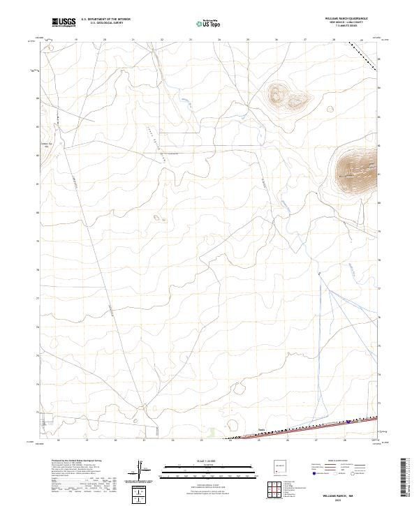
2023 Map of Williams Ranch
USGS Topo · Published 2023About this map
Tunis sits along the southern edge of this West New Mexico landscape, positioned where the I-10-Frontage-Rd meets the desert floor in Luna County. The terrain is defined by the ephemeral path of the Mimbres River, which winds south from the northern border toward the basin floor. High points like Black Mountain and Clabber Top Hill dominate the horizon, providing vertical contrast to the drainage patterns of Jones Spring Draw. The map reveals a network of rural routes including Clabber Top Rd and several county roads such as Co Rd D0116, which support the ranching operations that characterize this arid region. The surveyor's grid marks the transition between various townships, reflecting the late 20th and early 21st-century land management patterns of the high desert.
Find a feature on this map
16 named features on this map. Tap any name to fly to it.
Don’t see what you’re looking for? This feature index may not catch every label — zoom into the map to look around manually.
Map Details
Editions of this 2023 Williams Ranch Map
This is the sole edition of this map. No revisions or reprints were ever made.
Other maps of this area

1899 · Deming
USGS Topo · 1:125,000

1915 · Deming
USGS Topo · 1:125,000

1954 · Silver City
USGS Topo · 1:250,000

1955 · Las Cruces
USGS Topo · 1:250,000

1958 · Las Cruces
USGS Topo · 1:250,000

1958 · Silver City
USGS Topo · 1:250,000

1962 · Silver City
USGS Topo · 1:250,000
1963 · Antelope Hill
USGS Topo · 1:24,000

1963 · Gage
USGS Topo · 1:24,000
1964 · Grandmother Mountain East
USGS Topo · 1:24,000