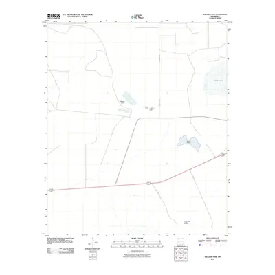
2010 Map of Williams Sink
USGS Topo · Published 2010About this map
The extractive industry of southeast New Mexico defines this landscape, characterized by significant potash production facilities situated in an arid basin. The National Potash Mine and its associated National Tailings occupy the central portion of the quadrangle, connected to the larger regional industrial network via County Rd-126a. This site reflects the specialized potash mining economy that has historically supported Lea County. Further south, the Hobbs Potash Facility Refinery stands as a focal point of processing activity.
Find a feature on this map
9 named features on this map. Tap any name to fly to it.
Don’t see what you’re looking for? This feature index may not catch every label — zoom into the map to look around manually.
Map Details
Editions of this 2010 Williams Sink Map
This is the sole edition of this map. No revisions or reprints were ever made.
Other maps of this area

1939 · Nash Draw
USGS Topo · 1:62,500

1942 · Clayton Basin
USGS Topo · 1:62,500

1943 · Clayton Basin
USGS Topo · 1:62,500

1943 · Nash Draw
USGS Topo · 1:62,500

1954 · Hobbs
USGS Topo · 1:250,000

1958 · Hobbs
USGS Topo · 1:250,000

1963 · Laguna Gatuna
USGS Topo · 1:62,500

1963 · Hat Mesa
USGS Topo · 1:62,500

1978 · Jal
USGS Topo · 1:100,000

1984 · Laguna Gatuna NW
USGS Topo · 1:24,000