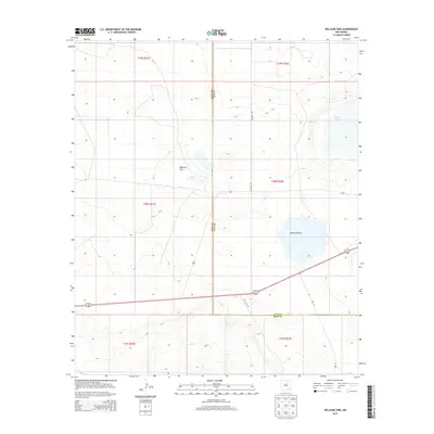
2013 Map of Williams Sink
USGS Topo · Published 2013About this map
Williams Sink and the surrounding alkaline depressions define this high desert landscape on the border of Eddy and Lea counties. In this 2013 survey, the topography is marked by significant ephemeral basins, including Laguna Toston and the northern reaches of Laguna Plata. These features represent the unique geomorphology of the Pecos River Valley region, where internal drainage and wind-scoured depressions create distinct landmarks in an otherwise subtle terrain. The road network reflects the region's modern utility, with Wipp Rd and Red Cloud Rd traversing the scrubland. This map provides a clear view of the township and range survey system, specifically covering sections of T19S, T20S, and T21S, which helps researchers pin down precise locations of land tracts and rural developments between the Pecos and the Llano Estacado.
Find a feature on this map
17 named features on this map. Tap any name to fly to it.
Don’t see what you’re looking for? This feature index may not catch every label — zoom into the map to look around manually.
Map Details
Editions of this 2013 Williams Sink Map
This is the sole edition of this map. No revisions or reprints were ever made.
Other maps of this area

1939 · Nash Draw
USGS Topo · 1:62,500

1942 · Clayton Basin
USGS Topo · 1:62,500

1943 · Clayton Basin
USGS Topo · 1:62,500

1943 · Nash Draw
USGS Topo · 1:62,500

1954 · Hobbs
USGS Topo · 1:250,000

1958 · Hobbs
USGS Topo · 1:250,000

1963 · Laguna Gatuna
USGS Topo · 1:62,500

1963 · Hat Mesa
USGS Topo · 1:62,500

1978 · Jal
USGS Topo · 1:100,000

1984 · Laguna Gatuna NW
USGS Topo · 1:24,000