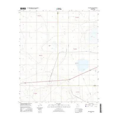
2017 Map of Williams Sink
USGS Topo · Published 2017About this map
Williams Sink and the surrounding high desert terrain define this landscape in the southeastern corner of New Mexico. In this contemporary survey, the arid hydrology of the region is centered on ephemeral basins and alkaline depressions like Laguna Plata and Laguna Toston, which sit among the low ridges of the Permian Basin. The area is marked by a network of specialized transit routes, including Buffalo Grass Rd and infrastructure supporting the Waste Isolation Pilot Plant, notably indicated by Wipp Rd and the Doe Wipp Acc access route. Spanning the border of Eddy and Lea counties, the map reveals a land primarily shaped by industrial transit and geological formations rather than dense settlement, offering a clear view of the modern infrastructure required to navigate this remote portion of the Llano Estacado.
Find a feature on this map
10 named features on this map. Tap any name to fly to it.
Don’t see what you’re looking for? This feature index may not catch every label — zoom into the map to look around manually.
Map Details
Editions of this 2017 Williams Sink Map
This is the sole edition of this map. No revisions or reprints were ever made.
Other maps of this area

1939 · Nash Draw
USGS Topo · 1:62,500

1942 · Clayton Basin
USGS Topo · 1:62,500

1943 · Clayton Basin
USGS Topo · 1:62,500

1943 · Nash Draw
USGS Topo · 1:62,500

1954 · Hobbs
USGS Topo · 1:250,000

1958 · Hobbs
USGS Topo · 1:250,000

1963 · Laguna Gatuna
USGS Topo · 1:62,500

1963 · Hat Mesa
USGS Topo · 1:62,500

1978 · Jal
USGS Topo · 1:100,000

1984 · Laguna Gatuna NW
USGS Topo · 1:24,000