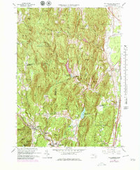
1964 Map of Williamsburg
USGS Topo · Published 1979About this map
Williamsburg and Haydenville anchor the Mill River valley during this mid-century revision, showing a landscape defined by its transition from industrial river power to a wooded, residential character. The southern portion of the map is dominated by the Boston and Maine railroad line terminating at the Williamsburg Station, a focal point for the local economy. Educational and social pillars like the Dunphy Sch and the Williamsburg Rod and Gun Club are clearly marked, while the surrounding hills—including Unquomonk Hill and Horse Mountain—are deeply etched with brooks and reservoirs that supplied water to nearby population centers. To the north, the terrain becomes more isolated within the Conway State Forest, where features like Joe Herrick Gulf and Cricket Hill Cem speak to the area’s rugged topography and early settlement history. The eastern flats of the Great Swamp provide a sharp contrast to the steep elevations of Spruce Hill and Mt Esther.
Find a feature on this map
98 named features on this map. Tap any name to fly to it.
Don’t see what you’re looking for? This feature index may not catch every label — zoom into the map to look around manually.
Map Details
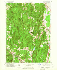
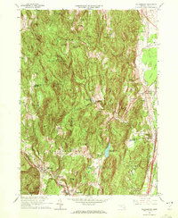
Editions of this 1964 Williamsburg Map
4 editions found

Other maps of this area

1885 · Northampton
USGS Topo · 1:62,500

1886 · Hawley
USGS Topo · 1:62,500

1886 · Chesterfield
USGS Topo · 1:62,500

1886 · Northampton
USGS Topo · 1:62,500

1888 · Chesterfield
USGS Topo · 1:62,500

1890 · Hawley
USGS Topo · 1:62,500

1890 · Greenfield
USGS Topo · 1:62,500

1891 · Northampton
USGS Topo · 1:62,500

1893 · Northampton
USGS Topo · 1:62,500

1893 · Chesterfield
USGS Topo · 1:62,500