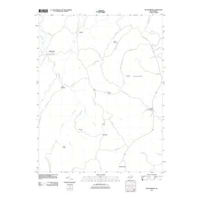
2011 Map of Williamsburg
USGS Topo · Published 2011About this map
Fort Donnally and Williamsburg anchor this rural Greenbrier County landscape, where the karst topography of the Appalachian plateau is evidenced by unique water features like Sinking Creek and Matts Black Cave Spring. The settlement pattern follows a network of ridge and valley roads, connecting small communities such as Unus, Sunlight, and Brantville. The map captures a transition from agricultural bottoms to prominent elevations like Butler Mountain and Miller Ridge. Local history is preserved in sites like the Pilgrim Rest Cemetery and the Williamsburg Post Office. This survey provides a modern view of traditional West Virginia hollows and flats, including Thorny Hollow and Chestnut Flat, illustrating how the early frontier outposts have evolved into a quiet landscape of fishing lakes and rural homesteads near the eastern edge of the quadrangle at Frankford.
Find a feature on this map
54 named features on this map. Tap any name to fly to it.
Don’t see what you’re looking for? This feature index may not catch every label — zoom into the map to look around manually.
Map Details
Editions of this 2011 Williamsburg Map
This is the sole edition of this map. No revisions or reprints were ever made.
Other maps of this area

1887 · Hinton
USGS Topo · 1:125,000

1887 · Lewisburg
USGS Topo · 1:125,000

1889 · Nicholas
USGS Topo · 1:125,000

1891 · Lewisburg
USGS Topo · 1:125,000

1891 · Nicholas
USGS Topo · 1:125,000

1891 · Huntersville
USGS Topo · 1:125,000

1892 · Hinton
USGS Topo · 1:125,000

1894 · Huntersville
USGS Topo · 1:125,000

1901 · Nicholas
USGS Topo · 1:125,000

1918 · Richwood
USGS Topo · 1:62,500