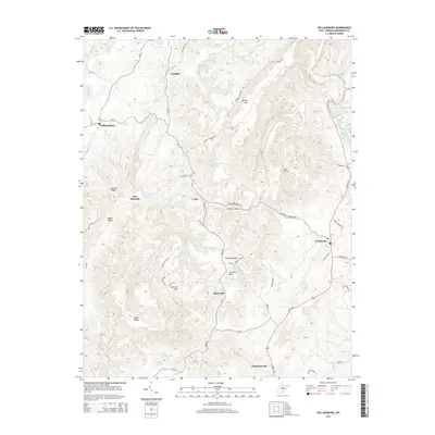
2014 Map of Williamsburg
USGS Topo · Published 2014About this map
Fort Donnally stands as a focal point of this Greenbrier County landscape, where the karst topography of the Appalachian plateau reveals itself through a dense network of springs and subterranean features. The settlement patterns follow the winding routes of Seneca Trl and Us-219, connecting the historic community of Williamsburg to Frankford and Clendenenville. The land is defined by sharp ridges and deep hollows, such as Brushy Ridge and Thorny Hollow, which separate the various family-named springs that dot the valleys.
Find a feature on this map
75 named features on this map. Tap any name to fly to it.
Don’t see what you’re looking for? This feature index may not catch every label — zoom into the map to look around manually.
Map Details
Editions of this 2014 Williamsburg Map
This is the sole edition of this map. No revisions or reprints were ever made.
Other maps of this area

1887 · Hinton
USGS Topo · 1:125,000

1887 · Lewisburg
USGS Topo · 1:125,000

1889 · Nicholas
USGS Topo · 1:125,000

1891 · Lewisburg
USGS Topo · 1:125,000

1891 · Nicholas
USGS Topo · 1:125,000

1891 · Huntersville
USGS Topo · 1:125,000

1892 · Hinton
USGS Topo · 1:125,000

1894 · Huntersville
USGS Topo · 1:125,000

1901 · Nicholas
USGS Topo · 1:125,000

1918 · Richwood
USGS Topo · 1:62,500