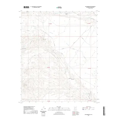
2020 Map of Williamsburg NW
USGS Topo · Published 2020About this map
Garcia Peaks dominate the southwestern quadrant of this Sierra County landscape, marking a topographically complex region where high ridges give way to a network of seasonal drainages. The northern portion of the map is defined by the Cuchillo-Negro Cr and the Cuchillo Community Ditch, which indicate a long-standing tradition of water management in this arid environment. These features, along with Hok Farm Canyon, suggest a history of ranching and land use tied to the sparse water sources of the high desert.
Find a feature on this map
33 named features on this map. Tap any name to fly to it.
Don’t see what you’re looking for? This feature index may not catch every label — zoom into the map to look around manually.
Map Details
Editions of this 2020 Williamsburg NW Map
This is the sole edition of this map. No revisions or reprints were ever made.
Other maps of this area

1954 · Tularosa
USGS Topo · 1:250,000

1958 · Tularosa
USGS Topo · 1:250,000

1961 · Priest Tank
USGS Topo · 1:24,000

1961 · Huerfano Hill
USGS Topo · 1:24,000

1961 · Saladone Tank
USGS Topo · 1:24,000

1961 · Williamsburg NW
USGS Topo · 1:24,000

1961 · Williamsburg
USGS Topo · 1:24,000

1961 · Cuchillo
USGS Topo · 1:24,000

1963 · Bell Mountain
USGS Topo · 1:24,000

1963 · Thumb Tank Peak
USGS Topo · 1:24,000