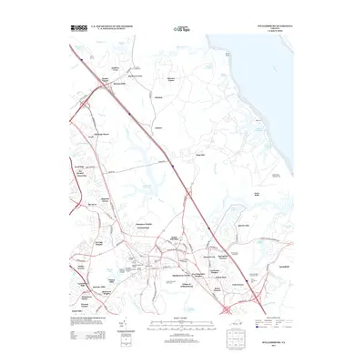
2013 Map of Williamsburg
USGS Topo · Published 2013About this map
The Village of Williamsburg serves as the heart of this modern survey, anchoring a landscape where colonial heritage and 21st-century development intersect. Historical landmarks like the Governor's Palace and the College Yard are prominently featured, situated near residential expansions such as Middletowne Farms and Charleston Heights. The map clearly delineates the complex network of heritage routes, including the Colonial National Historic Pkwy, which winds past the site of the Williamsburg Battlefield.
Find a feature on this map
114 named features on this map. Tap any name to fly to it.
Don’t see what you’re looking for? This feature index may not catch every label — zoom into the map to look around manually.
Map Details
Editions of this 2013 Williamsburg Map
This is the sole edition of this map. No revisions or reprints were ever made.
Other maps of this area

1906 · Williamsburg
USGS Topo · 1:62,500

1907 · Yorktown
USGS Topo · 1:62,500

1917 · Toano
USGS Topo · 1:62,500

1918 · Toano
USGS Topo · 1:62,500

1919 · Surry
USGS Topo · 1:62,500

1943 · Yorktown
USGS Topo · 1:62,500

1943 · Richmond
USGS Topo · 1:250,000

1944 · Yorktown
USGS Topo · 1:24,000

1949 · Richmond
USGS Topo · 1:250,000

1950 · Cobham Bay
USGS Topo · 1:24,000